Saturday, May 31, 2008

Tornado Outbreak Recap....More on the Horizon


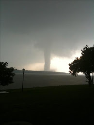
This photo (courtesy of the National Weather Service) is from the tornado that hit Parkersburg, Iowa last Sunday, May 25th. It has been rated as an EF-5, the first since Greensburg last year and the first in Iowa in 30 years. The entire first floor is gone, and the basement has been left exposed. Unfortunately, this tornado has now raised the number of tornado deaths this year to over 100, which is the highest in a decade. The past week has seen a major tornado outbreak. 269 tornadoes have touched down between 5/22 and 5/30 in every Great Plains state from Mexico to the Canadian border. Kansas has been the hardest hit state with nearly 100 tornadoes there alone.

Unfortunately tornado season doesn't want to die yet. In fact, at least for Oklahoma, the worst may be yet to come. A very powerful storm for June standards will be making it's presence known between next Wednesday and next Friday, 6/4-6/6. Right now it appears as though the area from the Red River on north to the Great Lakes has the potential to see a widespread and very significant tornado outbreak, including more strong/violent and long-tracked tornadoes. This is definitely a storm to watch closely over the next few days.

Thursday, May 22, 2008

Colorado/Kansas Tornadoes.....and a RANT

First I want to start off by saying that there were 50 tornado reports today, mainly in Western Kansas. Some large tornadoes, as a matter of fact. From the reports I have seen so far no towns were hit, thank goodness that area of Kansas is very rural. As for the video of the very large tornado north of Denver.....wow. From what I have seen it looks like EF-3 damage. You would have thought F-5 after seeing that video, but the size of tornadoes doesn't always coorelate to how strong they are. Generally the larger the tornado the stronger it is, but not always. In any case, the tornado was massive. In the weather world we call it a wedge tornado.

What was amazing to me is that the temperature was only 58 degrees as the tornado was occuring! There had to have been incredible wind shear to produce that tornado with a temperature that low. It just goes to show how much we still don't know about tornado formation.

I will post a forecast for Friday and the weekend on Friday. I think the tornado outbreak will continue in Kansas and Nebraska.

I have a rant to post about some irresponsible weather coverage I saw tonight. I don't have a degree or TV experience, but this is just my opinion. A local TV guy showed footage of a brief tornado outside of the small town of Hammon in Western Oklahoma. Hint: it wasn't Gary England or Rick Mitchell. To me it appeared the tornado lifted a minute or so later. TV guy goes to radar and starts commenting on a "donut hole" that he sees on radar. He then goes on to state that it is a mile wide, and this is an indication that there is a large tornado moving directly toward Hammon. He did not confirm this with storm tracker reports either. How would you have felt if a TV meteorologist had claimed a mile-wide tornado was moving toward your hometown, and it was just a "false alarm"?

To be honest it made me angry. Radar is a helpful tool, but only in rare situations can you actually pinpoint a tornadic circulation on it. If you are going to claim a mile-wide tornado is on the ground, you better be *darn* sure it is there by confirming with your spotters. This kind of reporting is what gives meteorologists a bad rap about blowing things out of proportion. Thank you to the other 2 stations for keeping your sense of sanity. As for the other station, thank you for your ridiculous Broadway production.

Wednesday, May 21, 2008

Thursday Update

The Storm Prediction Center has issued a moderate risk of severe weather for Western & Central Kansas and extreme NW Oklahoma. This area of Kansas has a threat for a few strong and long-lived tornadoes Thursday afternoon and evening. In the rest of Western & Central Oklahoma there is a slight risk of severe weather, but don't be fooled by the term "slight". Any storm that develops in the state tomorrow afternoon and evening has the potential to produce a significant tornado, in my opinion.

Later this afternoon and evening, and especially Thursday morning, you should feel the difference in the air as compared to what the air feels like as of Wednesday at Noon. Very humid air that is now residing over south Texas and the Gulf of Mexico is going to flood the state tonight. This air is the key ingredient for producing significant severe weather.

Bottom line: I would keep informed of weather conditions Thursday afternoon and evening....(it's hard NOT to be informed with our TV weathermen). I can't tell you where and exactly when, but my gut tells me something significant is going to happen tomorrow.

Monday, May 19, 2008

Memorial Weekend Tornado Outbreak

It is looking more and more evident that a violent tornado outbreak will occur this Thursday through Sunday, but fortunately the area of concern is west of OKC. The affected areas are looking likely to be western Nebraska, western Kansas, and the Oklahoma and Texas panhandles. Unfortunately for these areas, the storm is going to stall-out and produce repeated rounds of very severe weather over the same areas over multiple days. If OKC gets any severe weather I would say it is more likely to be around Sunday and Memorial Day, and I don't think it will be a tornado outbreak like further west.

Like always this can change. If it does I'll post an update.

Friday, May 16, 2008

Update For Next Week

WOW......

There are two main computer models that are used to forecast in the medium to long-term. Both of them are in relatively good agreement, which is a rare thing 7 days in advance. The time period beginning next Thursday and then lasting for about a week could rival the 2003 tornado outbreak sequence of May 4-10, which collectively produced 401 tornadoes across the country. As of right now, the following states are at greatest risk, in my opinion: Kansas, Nebraska, Missouri, Arkansas, Iowa, South Dakota, and yes, Oklahoma. This is going out on a limb, but I would expect the Storm Prediction Center to issue 1 or 2 rare high-risks somewhere in the above mentioned areas, possibly beginning as early as Thursday, May 22.

As we know, things can definitely change. But the fact that one of these models has been consistent in showing this pattern developing for almost a week now has me feeling confident in making the above predictions. I just hope all of the tornadoes stay out in open fields, because my gut tells me there is going to be a lot of them.

Wednesday, May 14, 2008

Severe Weather Ahead

I thought the severe weather potential next week deserved a post. A pretty nasty looking storm is showing up for later next week into next weekend (May 22nd-May 26th). The computer models have been pretty consistent in showing this developing, so even though it is over a week away, I am starting to feel fairly confident that a tornado outbreak will occur on the Plains during this timeframe. Locations/specifics are still way to early to pin down, but this situation looks like a classic Oklahoma severe weather event, instead of the surprise spin-up mini-tornadoes we have been getting here in the city the past couple of months.

Also, I haven't blogged since the outbreak this past Saturday that included the tornado in Picher. Very sad, especially considering the plight of the town regardless of the tornado. The tornado was rated EF-4, the first tornado in Eastern Oklahoma rated that high since 1993. The tornado hit really close to home for a friend of ours, and she recently blogged about it.

The width of the tornado was a mile at it's widest, and the path length was an unbelievable 76 miles. To put that in perspective, no tornado on May 3, 1999 had a path length that long. One tornado being on the ground for that long is extremely rare. The norm is for a supercell to create a "family" of tornadoes, where one tornado dissipates, and then the storm re-organizes and a while later puts down a new tornado, and so on.

Friday, May 2, 2008

May 3, 1999

It's hard to believe that we're at the 9th anniversary of the largest tornado outbreak in Oklahoma history. My memories are still vivid from that day. I remember leaving school that afternoon and feeling how hot and humid it was outside. The sky looked and felt angry. If you have lived in Oklahoma a while, you know that feeling. I had to work that night (and yes, I wish I would have called in sick to watch the live coverage), but before I left for work I was watching Gary England showing the first tornado touchdown of the day, SW of Chickasha. I expected the tornado to be on the ground for a minute or so and then lift, as most tornadoes do. As we all know, these weren't going to be like "most tornadoes." Before I left for work I turned to my dad and said, "tonight is going to be a bad night." Little did I know how bad it would turn out to be.

I still remember how green the sky turned later that night. I remember calling my parents to find out how many different tornadoes there were at any given time and if there were any headed towards us. I also remember the guilt I felt for being excited about tornadoes after finding out how bad the destruction was.

I have listed a few facts and other things you may not know about May 3, 1999. Also, share any memories you have from that day, if you would like.

-A total of 70 tornadoes were reported that day, a majority of them from 3 different supercell thunderstorms.

-The most "infamous" tornado of the day was the one that struck Moore. However, after dark, a tornado that struck Mulhall (just north of Guthrie) was possibly just as intense, IF NOT more intense, than the Moore tornado. Since no structures were hit and the tornado was in open country at its' peak, we will never know. Radar and a few storm spotters have placed estimates that the circulation itself was possibly over 2 miles wide at times!

-It was not evident until later in the afternoon that a tornado outbreak was imminent. In fact, only a slight risk of severe weather was forecast the morning of May 3rd. It was upgraded to a moderate risk around noon, and a high risk around 3PM.

-The events of that day finally put to rest a popular misconception....that highway overpasses are a safe place to seek shelter. NEVER, EVER, WHATSOEVER seek shelter from a tornado under an overpass. You might as well stand in a wind tunnel with debris thrown in it.

-For the first time in National Weather Service history, a "Tornado Emergency" was issued. National Weather Service forecasters felt that the term "Tornado Warning" was not enough for the situation. Since then, Tornado Emergencies have been issued only when a large tornado is headed directly for a population center.....eg. Greensburg. Below is the original text for the OKC "Tornado Emergency"

SEVERE WEATHER STATEMENT
NATIONAL WEATHER SERVICE NORMAN OK
657 PM CDT MON MAY 3 1999

...TORNADO EMERGENCY IN SOUTH OKLAHOMA CITY METRO AREA...

AT 657 PM CDT...A LARGE TORNADO WAS MOVING ALONG INTERSTATE 44 WEST OF NEWCASTLE. ON ITS PRESENT PATH...THIS LARGE DAMAGING TORNADO WILL ENTER SOUTHWEST SECTIONS OF THE OKLAHOMA CITY METRO AREA BETWEEN 715 PM AND 730 PM. PERSONS IN MOORE AND SOUTH OKLAHOMA CITY SHOULD TAKE IMMEDIATE TORNADO PRECAUTIONS! THIS IS AN EXTREMELY DANGEROUS AND LIFE THREATENING SITUATION. IF YOU ARE IN THE PATH OF THIS LARGE AND DESTRUCTIVE TORNADO...TAKE COVER IMMEDIATELY.